


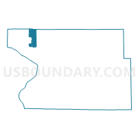
FOSTER 4 Voting District, Madison County, Illinois
About
Outline

Summary
| Unique Area Identifier | 573241 |
| Name | FOSTER 4 Voting District |
| County | Madison County |
| State | Illinois |
| Area (square miles) | 9.04 |
| Land Area (square miles) | 8.87 |
| Water Area (square miles) | 0.17 |
| % of Land Area | 98.14 |
| % of Water Area | 1.86 |
| Latitude of the Internal Point | 38.95951330 |
| Longtitude of the Internal Point | -90.13514360 |
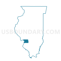
Maps

Graphs
Select a template below for downloading or customizing gragh for FOSTER 4 Voting District, Madison County, Illinois


Neighbors
Neighoring Voting District (by Name) Neighboring Voting District on the Map
- ALTON 2 Voting District, Madison County, IL
- ALTON 21 Voting District, Madison County, IL
- ALTON 28 Voting District, Madison County, IL
- BRIGHTON 3 Voting District, Macoupin County, IL
- FOSTER 1 Voting District, Madison County, IL
- FOSTER 2 Voting District, Madison County, IL
- FOSTER 3 Voting District, Madison County, IL
- GODFREY 10 Voting District, Madison County, IL
- GODFREY 11 Voting District, Madison County, IL
- GODFREY 13 Voting District, Madison County, IL
- GODFREY 2 Voting District, Madison County, IL
- PIASA 2 Voting District, Jersey County, IL
- WOOD RIVER 17 Voting District, Madison County, IL
Top 10 Neighboring County Subdivision (by Population) Neighboring County Subdivision on the Map
- Wood River township, Madison County, IL (31,537)
- Alton township, Madison County, IL (27,865)
- Godfrey township, Madison County, IL (17,982)
- Foster township, Madison County, IL (4,091)
- Brighton township, Macoupin County, IL (4,039)
- Piasa township, Jersey County, IL (3,376)
Top 10 Neighboring Place (by Population) Neighboring Place on the Map
Top 10 Neighboring Unified School District (by Population) Neighboring Unified School District on the Map
- Alton Community Unit School District 11, IL (49,134)
- Southwestern Community Unit School District 9, IL (9,504)
Top 10 Neighboring State Legislative District Lower Chamber (by Population) Neighboring State Legislative District Lower Chamber on the Map
- State House District 97, IL (103,784)
- State House District 98, IL (103,277)
- State House District 111, IL (103,196)
Top 10 Neighboring State Legislative District Upper Chamber (by Population) Neighboring State Legislative District Upper Chamber on the Map
Top 10 Neighboring 111th Congressional District (by Population) Neighboring 111th Congressional District on the Map
- Congressional District 19, IL (672,930)
- Congressional District 12, IL (666,459)
- Congressional District 17, IL (634,792)
Top 10 Neighboring Census Tract (by Population) Neighboring Census Tract on the Map
- Census Tract 4027.01, Madison County, IL (7,517)
- Census Tract 9566, Macoupin County, IL (4,804)
- Census Tract 4028.01, Madison County, IL (3,527)
- Census Tract 102, Jersey County, IL (3,494)